NATION WIDE DRONE SERVICES INSURED, DGCA CERTIFIED PILOTS AND DRONES FOR PAN INDIA DEPLOYMENT

Our goal then and now is to provide quality on time projects

Explore Services

Welcome to
GeoDrone Solutions, Delhi

About Us

GeoDrone Solutions is a New Delhi, India-based privately held company specializing in Drone and Geospatial Solutions.

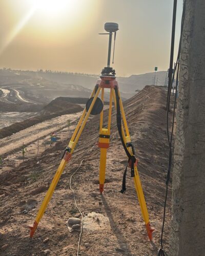
We provide cutting-edge technology, including Drones integrated with Visual/Thermal/LiDAR sensors-based survey, Differential GPS (DGPS) survey, GPS survey, Total Station survey, advanced Photogrammetry Software, Geographic Information Systems (GIS), Remote Sensing and Artificial Intelligence/Machine Learning (AI/ML).

At GeoDrone Solutions, we are committed to leveraging the power of technology to provide innovative and precise solutions to our clients, ensuring efficiency and accuracy in every project we undertake

Call Us Today​

+91 885-140-9728

Our Specialization​

At Geodrone Solutions, we specialize in delivering innovative, high-quality solutions tailored to meet the unique needs of each client. With a focus on excellence and customer satisfaction, we empower businesses to thrive in an ever-evolving market. Let us help you achieve your goals with precision, creativity, and unmatched expertise.

Transmission line Inspection:

“Elevating Reliability, One Flight at a Time: Transforming Transmission Line Inspection with Cutting-Edge Drone Technology.”

Solar Module Inspection:

“Solar Precision from Above: Revolutionizing Efficiency with Drone-Powered Solar Panel Inspections.”

Mining:

“Unleashing Efficiency from the Sky: Elevate Your Mining Operations with Drone-Precision Volumetric Measurements.”

Agriculture:

“Cultivating Tomorrow’s Harvest: Harnessing Drone Precision for Smart Agriculture, Crop Vigilance, and Precision Mapping.”

Railways:

“Railways Redefined: Drone-Powered Insights for Optimal Asset Management, Progress Tracking, and Feasibility Surveys.”

Road/Highways​​

“Highways Transformed: Aerial Precision for Tracking Progress and Crafting Tomorrow’s Infrastructure with Topographical Mastery.”

Construction:

“Building Tomorrow, Monitoring Today: Enhancing Construction Sites with Drone-Based Precision and Real-Time Monitoring.”

Telecom Tower:

“Connecting Beyond Boundaries: Drones Empowering Telecom Excellence.”

BIM:

“Precision Beyond Measure: Transforming Construction with BIM and LiDAR Excellence.”

Wind Turbine Generator:

“Elevating Wind Energy Reliability: Precision in the Sky for Turbine Excellence.”

Our Services

Discover our Drone Survey and Mapping Services, offering fast, accurate and cost-effective aerial data collection for a variety of applications using advanced UAV technology, we deliver high-resolution imagery and precise 3D mapping & Modeling solutions for industries such as Railways, Highways, Mines, Renewable sector, Agriculture, Irrigation etc.

View All Services→

CLIENTS

RITWIK Addwatt Jackson venture Jackson venture indian-railways

CLIENTS

National_Highways MORTH SAIYADRIOMSHIV TEST MORTH

CLIENTS

Hdfc helth Raj Corporation Jackson green Torrent_PowER

+
Clients
+
Projects
+
employee