Road/Highways

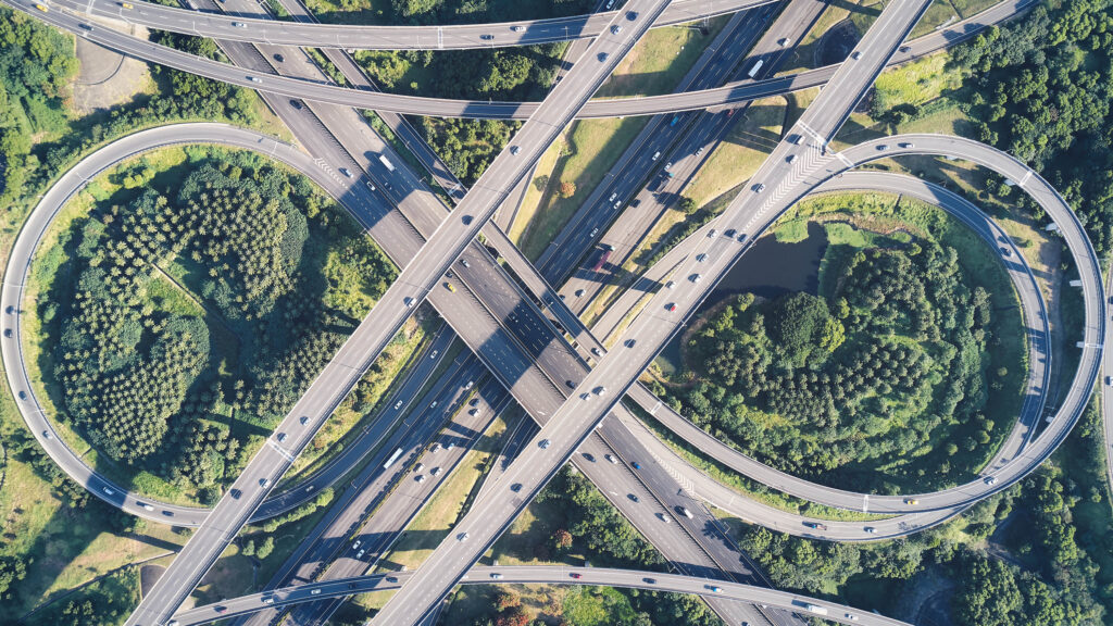
“Highways Transformed: Aerial Precision for Tracking Progress and Crafting Tomorrow’s Infrastructure with Topographical Mastery.”
The application of drones in the roads and highways sector has significant implications for improving infrastructure management, safety, and overall efficiency. Here are key aspects highlighting the significance of drone technology in the roads and highways industry:
Road Inspection and Maintenance:
Drones can conduct aerial inspections of roads and highways, capturing high-resolution images and data. This aids in identifying issues such as cracks, potholes, and signs of wear and tear, allowing for proactive maintenance planning.
Asset Inventory and Management:
Drones assist in creating accurate inventories of road assets, including signs, signals, guardrails, and lighting. This data facilitates asset management, helping authorities plan for repairs, replacements, and upgrades more effectively.
Traffic Management and Planning:
Drones can monitor traffic flow and congestion, providing real-time data for traffic management and planning. This information is valuable for optimizing traffic signal timings, identifying bottlenecks, and improving overall transportation efficiency.
Surveying and Mapping:
Drones can conduct topographic surveys and create detailed maps of road and highway infrastructure. This information supports planning for new construction projects, road expansions, and maintenance activities.
Emergency Response and Incident Management:
Drones can be deployed during emergencies, such as accidents or natural disasters, to assess the extent of damage and guide emergency response teams. They provide situational awareness, helping authorities make informed decisions quickly.
Bridge Inspection:
Drones can access and inspect bridges, viaducts, and overpasses, capturing detailed images of structural elements. This aids in identifying structural issues, corrosion, or other defects without the need for manual inspections in challenging and elevated locations.
Environmental Monitoring:
Drones can monitor environmental factors such as erosion, landslides, and vegetation growth along roadways. This information assists in planning mitigation strategies and maintaining the ecological balance around transportation corridors.
Construction Monitoring:
Drones provide real-time monitoring of construction projects, allowing project managers to track progress, identify potential issues, and ensure compliance with design specifications. This enhances overall project management efficiency.
Pavement Condition Assessment:
Drones equipped with sensors can assess the condition of road surfaces, detecting variations in pavement quality. This data is crucial for prioritizing maintenance and rehabilitation efforts.
Cost Efficiency:
Drones contribute to cost efficiency by reducing the time and resources required for inspections, surveys, and data collection. They enable more frequent and detailed assessments, leading to proactive and cost-effective maintenance strategies.
Remote Sensing in Challenging Terrain:
Drones can access remote or challenging terrain, such as mountainous areas or areas with limited accessibility. This is particularly beneficial for inspecting roads and infrastructure in regions where traditional methods may be impractical.
In summary, the significance of drone applications in the roads and highways sector lies in their ability to enhance infrastructure management, safety, and overall efficiency. Drones contribute to proactive maintenance, emergency response, and data-driven decision-making, ultimately leading to improved transportation systems.
