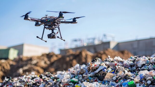
Managing large-scale waste dumps—whether from mining, construction, or industrial activities—requires accurate volume assessment for environmental compliance, space optimization, and operational planning. Enter the Drone Survey for Waste Dump Volume Calculation a high-tech solution offering quick, precise, and safe data collection from the sky.
Gone are the days of tedious manual surveys and guesswork. With drone technology, waste volume calculation is now efficient, cost-effective, and data-rich.

Why Use Drones for Volume Calculation?
Using drones equipped with high-resolution cameras and GPS, surveyors can capture aerial imagery of dump sites. This data is processed into 3D models and digital surface maps, allowing software to calculate the exact volume of waste with minimal human effort.
Technologies Used in Drone Waste Dump Volume Calculation
- Photogrammetry Drones: Ideal for large, exposed waste dumps with good lighting conditions.
- LiDAR Drones: Best for capturing data in vegetated or dusty areas where visual sensors may struggle.
- RTK/PPK GPS Modules: Enhance positional accuracy of aerial surveys.
- GIS & CAD Software: For volume analysis, modeling, and data integration with existing systems.
The Drone Survey Workflow for Waste Dumps
- Flight Planning: Use ground control points (GCPs) and mission planning software to define the drone’s flight path.
- Data Capture: The drone flies over the dump site capturing hundreds to thousands of high-resolution images or LiDAR scans.
- Processing the Data: Specialized software (e.g., Pix4D, DroneDeploy, or Global Mapper) converts images into a 3D surface model.
- Volume Calculation: The model is compared to a base level or previous survey to calculate the volume of waste accurately.
- Reporting & Analysis: Generate detailed reports for compliance, forecasting, and operational insights.
Benefits of Drones for Waste Dump Volume Calculation
- High Accuracy (centimeter-level precision)
- Fast Turnaround – large areas covered in minutes
- Safe and Non-Invasive – no need to climb unstable mounds
- Cost-Effective – reduces manpower and equipment needs
- Repeatable – easy to monitor volume changes over time

Where It’s Used
- Industrial waste yards
- Municipal solid waste landfills
- Construction and demolition debris sites
- Railway and mining overburden dumps
Conclusion
A Drone Survey for Waste Dump Volume Calculation is more than just a tech upgrade—it’s a leap toward smarter, safer, and more sustainable waste management. From mining giants to city landfills, drones are revolutionizing how we measure and manage waste, one flight at a time.